


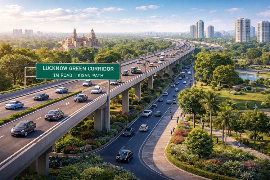
Lucknow Green Corridor: The Roadmap to a Faster, Smarter Capital
Lucknow Green Corridor: The Roadmap to a Faster, Smarter Capital
Lucknow: Lucknow is changing at a pace few could have imagined a decade ago. Expanding residential townships, rising commercial hubs, educational institutions, and growing vehicle ownership have transformed the city into one of North India’s fastest-evolving urban centres. But this rapid growth has come with a cost — traffic congestion, overburdened bridges, railway crossings that choke movement, and junctions that frequently turn into bottlenecks during peak hours. To address these structural mobility challenges, the Lucknow Development Authority has undertaken one of the most ambitious infrastructure projects in the city’s history: the Lucknow Green Corridor.
Envisioned as a high-capacity, largely signal-free north–south arterial spine, the Green Corridor is designed to fundamentally transform the way people move across the capital. It is not merely a road-widening exercise but a comprehensive re-engineering of traffic flow across critical stretches of the city.
The Vision Behind the Corridor
At its core, the Green Corridor is about uninterrupted mobility. The project spans roughly 28 kilometres, linking IIM Road in the south-west to Kisan Path in the north-east. By integrating multiple flyovers, railway overbridges, underpasses, bridges and redesigned intersections, the corridor seeks to create what traffic engineers often call a “green wave” — a stretch where vehicles can maintain steady speeds without frequent halts at signals or roundabouts.
The name “Green Corridor” does not solely refer to landscaping or environmental features. Rather, it reflects the emphasis on smooth, free-flowing movement. In a city where daily commutes could easily stretch to an hour for distances under 10 kilometres, this shift represents a structural change in urban planning philosophy.
Addressing Chronic Congestion
Lucknow’s traffic pressure has long been concentrated at certain flashpoints. Gomti river crossings, the 1090 intersection, Nishatganj, Hanuman Setu, Samtamulak crossing, Pipraghat railway crossing, and routes near Ekana Stadium have frequently witnessed heavy congestion. During events, peak office hours, or festive seasons, the situation often escalated into gridlocks spilling into adjoining residential lanes.
The Green Corridor strategically bypasses many of these hotspots. Elevated sections and railway overbridges eliminate waiting time at level crossings. Flyovers over busy junctions reduce the need for signal-controlled stoppages. Feeder roads have been widened to distribute traffic more evenly. By diverting through-traffic away from crowded inner-city stretches, the corridor ensures that local roads can better serve neighbourhood movement instead of carrying city-wide flows.
Travel Time Transformation
Perhaps the most visible impact of the project lies in travel time reduction. On operational stretches of Phase 1, commuters have already reported their journeys dropping from 45–60 minutes to nearly 20–25 minutes. Sections connecting Daliganj to Samta Mulak are expected to cut Old Lucknow to Gomti Nagar travel time to as little as 10 minutes in certain scenarios.
Once the full north–south alignment becomes functional, experts estimate that cross-city travel time could reduce by nearly half. What was once an exhausting hour-long crawl may become a predictable 15–30 minute drive. For office-goers, students, business operators and emergency services, this reliability can be transformative.
Phased Development and Investment
Given its scale, the Green Corridor has been divided into four phases to ensure manageable construction timelines and funding flows. The overall cost is estimated at around ₹7,000 crore, reflecting the magnitude of engineering and land development involved.
Phase 1, covering approximately 6.8 kilometres from IIM Road to Hardinge Bridge, became operational in early 2024. This stretch has already begun easing pressure on southern routes. Phase 2 has seen substantial progress, with key sections opened or nearing inauguration in early 2026. Phase 3, stretching roughly five kilometres from Pipraghat to Shaheed Path, includes the construction of a 240-metre railway overbridge along with extensive embankment work and bridge development. Phase 4 focuses on integrating flyovers and connecting links, including alignment with the G-20 Road corridor, with accelerated funding aimed at mid-2026 completion.
Complementary projects, such as new flyovers along Shaheed Path and widened feeder roads, enhance the corridor’s overall effectiveness. The phased approach has allowed authorities to address design adjustments and traffic feedback in real time, refining junction layouts and slip roads where needed.
Economic Momentum and Urban Expansion
Infrastructure is often the backbone of economic growth, and the Green Corridor is poised to act as a catalyst for Lucknow’s next phase of expansion. Improved connectivity to emerging residential areas like Arjunganj and commercial zones around the Gomti riverfront increases their attractiveness for investment. Enhanced access to Ekana Stadium and other event venues ensures smoother crowd management during large gatherings.
Faster freight movement through outer linkages to Ayodhya Road, Kanpur Road and Kisan Path also reduces the burden on central markets. Businesses benefit from shorter logistics cycles, while property values along well-connected corridors typically witness appreciation. In this sense, the Green Corridor is not just easing traffic; it is reshaping real estate dynamics and commercial geography.
Environmental and Safety Gains
Although designed primarily for traffic efficiency, the corridor carries environmental benefits as well. Reduced idling at signals means lower fuel consumption and decreased emissions. Vehicles maintaining steady speeds produce fewer pollutants than those caught in stop-and-go patterns. Over time, this could contribute to marginal improvements in urban air quality.
Safety is another crucial dimension. Wider carriageways, improved merging lanes, elimination of sharp turns and removal of railway level crossings significantly reduce accident risks. Redesigned intersections with proper channelization minimize conflict points. As vehicle volumes continue to grow, such forward-looking design becomes essential.
Challenges and Course Corrections
Large-scale urban infrastructure rarely unfolds without hurdles. Early operations on certain stretches witnessed minor congestion at redesigned roundabouts or slip roads. Feedback from traffic police and commuters led to modifications, including signal recalibration and geometric adjustments. Drone surveys and real-time monitoring have supported evidence-based corrections.
Land acquisition and coordination with multiple departments also posed logistical challenges. However, phased implementation has allowed these complexities to be managed without stalling overall momentum.
A Structural Shift in Urban Mobility
The Lucknow Green Corridor represents more than a transport project; it signals a structural shift in how the city envisions mobility. Instead of reactive widening of existing roads, the approach here is systemic — building an integrated arterial spine capable of absorbing future growth.
As completion of the remaining phases approaches, the corridor is expected to serve millions of residents daily. By turning fragmented road networks into a cohesive, high-speed urban backbone, the project promises to redefine everyday commuting in Lucknow. Reduced stress, saved time, enhanced safety and improved economic access collectively mark a turning point for Uttar Pradesh’s capital.
If delivered in full as planned by mid-2026, the Green Corridor may well stand as a benchmark in state-led urban infrastructure — demonstrating how strategic planning and sustained investment can reshape not just roads, but the rhythm of an entire city.
What's Your Reaction?